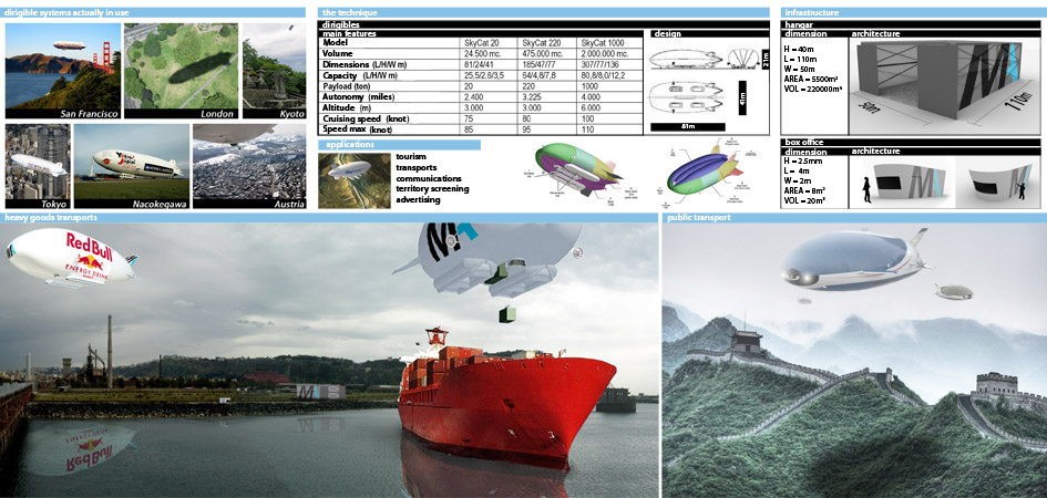
| The system involves the identification of three sub areas: the Euro-Mediterranean area (from Rome to Beirut), Middle East Area (from Beirut to Islamabad), Asian area (from Islamabad to Nagasaki). Each of them represents the maximum feasible autonomy by airship in one trip (about 5,000 km). The blimp did not require heavy infrastructures for the landing area and can cover capillary connections between the areas concerned by the route. This makes it possible to connect distant places directly, reach inaccessible areas, improve access to more remote areas of the Silk Road. Many are also benefits for the movement of goods, heavy and indivisible loads in particular. The proposed technology represents a synthesis of three major projects identified in contemporary literature: Aeroscraft, Skycat, Sky Hook (Boeing). The interest shown by the aviation industry for this type of aircraft shows the enormous potential of this technology and candidate it to be the new sky caravan along the Silk Road. |